Research interests
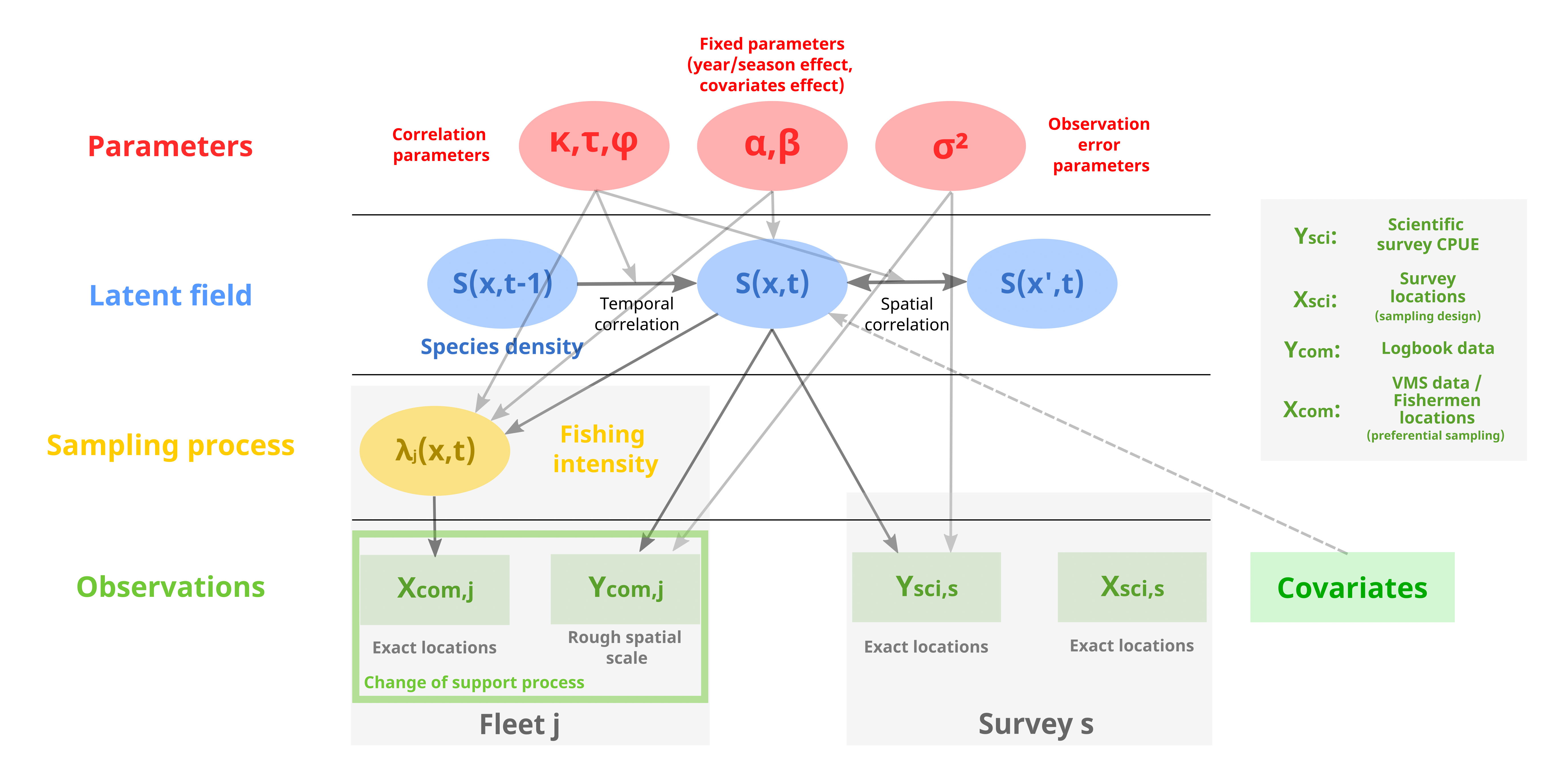
Inferring species spatio-temporal distribution from multiple data sources
Alglave B., Mourguiart B., Vermard Y., Rivot E., Woillez M., Kristensen K., Etienne M.P. (2025). Change of support for zero-inflated data: deriving fine scale species distribution inferences from spatially aggregated data. Journal of the Royal Statistical Society Series C: Applied Statistics. link
Alglave B., Vermard Y., Rivot E., Etienne M.P., Woillez M. (2023). Identifying mature fish aggregation areas during spawning season by combining catch declarations and scientific survey data. Canadian Journal of Fisheries and Aquatic Sciences. link
Alglave B., Rivot E., Etienne M.P., Woillez M., Thorson J.T., Vermard Y. (2022). Combining scientific survey and commercial catch data to map fish distribution.ICES Journal of Marine Science. link
Dimension reduction for spatio-temporal ecological data
Michel M., Alglave B., Olmos M., Torterotot M., Virgili A., Martin-Marin S., Royer J.Y., Samaran F. (2025). Modelling the influence of environmental factors on the acoustic presence of blue whale populations in the Southern Indian Ocean. Scientific Reports (Nature). link
Alglave B., Olmos, M., Casemajor, J., Etienne, M. P., Rivot, E., Woillez, M., Vermard, Y. (2024). Investigating fish reproduction phenology and essential habitats by identifying the main spatio-seasonal patterns of fish distribution. ICES Journal of Marine Science. link
Alglave B., Dufée B., Obakrim S., Thorson J. T. (in prep). Empirical Orthogonal Functions for ecology. link

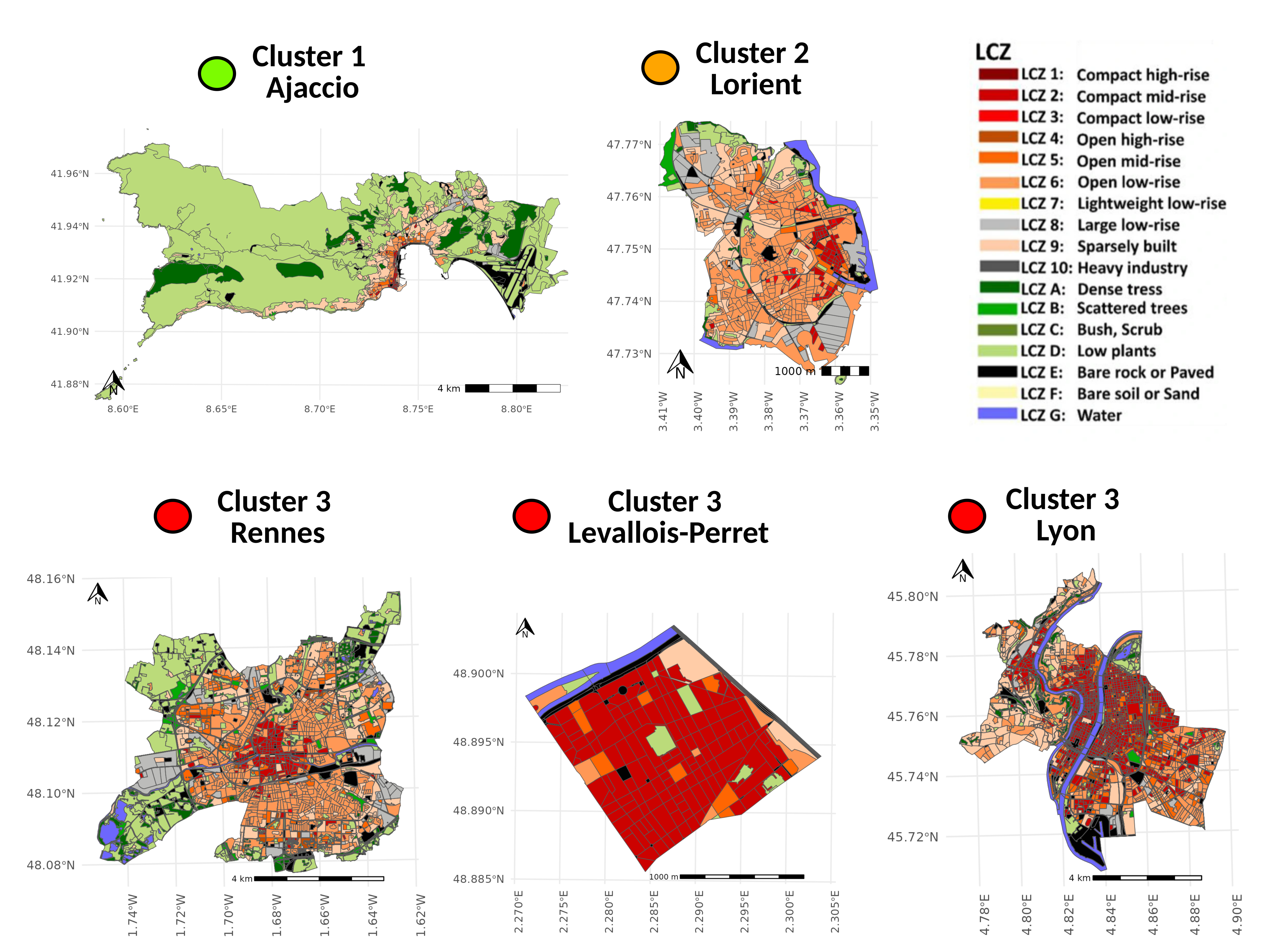
Classifying urban profiles based on overheating factors
- Alglave B., Besnard P., Bernard J., Bocher E., Gousseff M., Leconte F. (2025). Identifying urban profiles with regard to overheating factors. Application to French municipalities (SAGEO conference). Avignon, France, May 2025. link1, link2